
How Optimal Location works
It answers one question: if the new place were here, how much time would all the trips to and from it take? Then it looks for the spot where that total is smallest.
Three steps
- Add the places that matter. Wherever people or goods travel to or from, and how many trips each place gets. A family's office and school. The areas a team lives in. A warehouse's suppliers and customers. The cities wedding guests come from.
- Say how people travel. Tick what's available: road, bus or metro, bicycle, train, flights. Choose whether trips are counted per week, per month, per year or once, how heavy town traffic is, and whether to count the journey back.
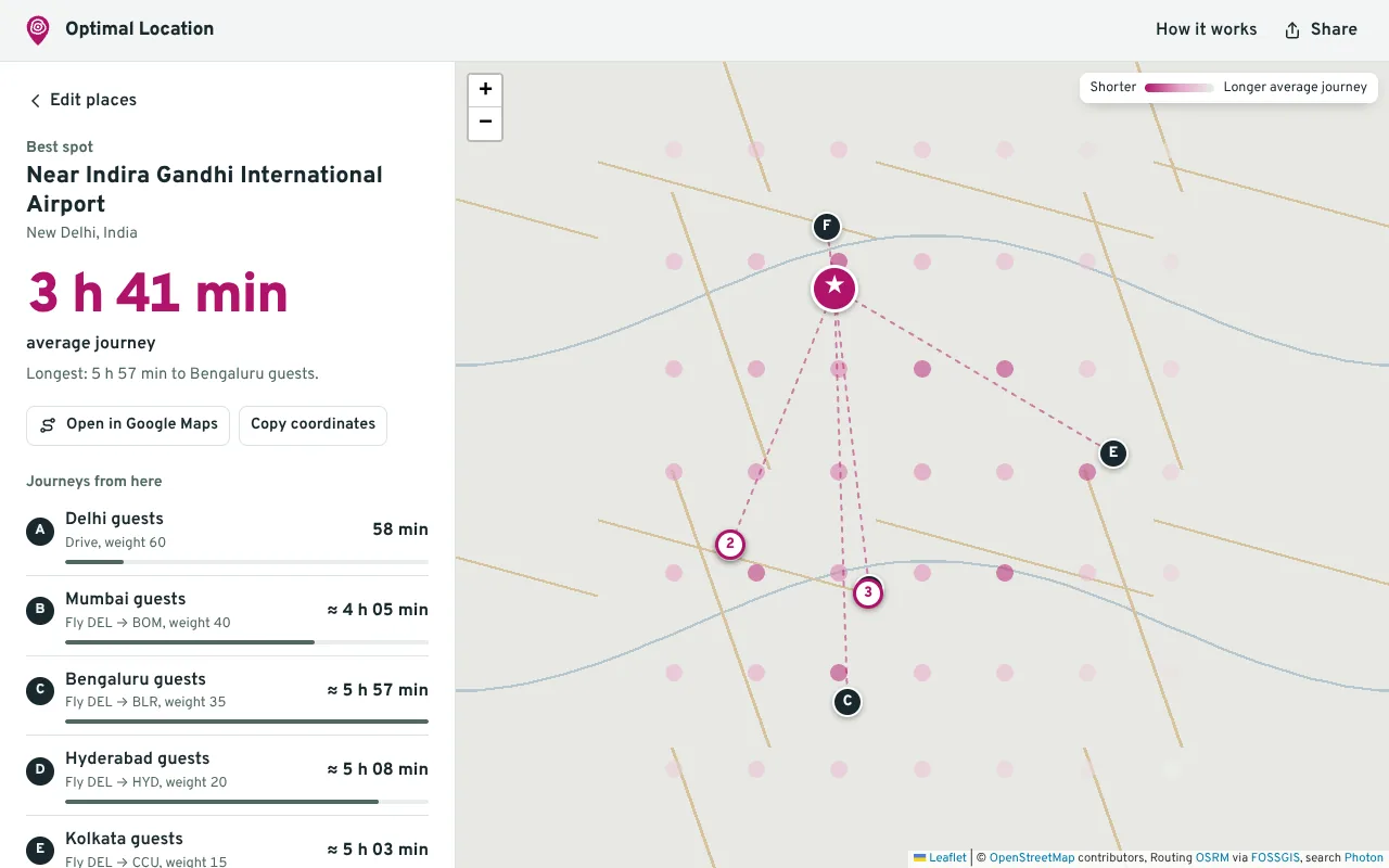
- Find the best spot. We measure travel times from dozens of spots around your places (and nearby airports, for long trips), keep the most promising ones and zoom in until the grid is fine enough. You get the best spot, two alternatives and a trip-by-trip breakdown.
How it picks the way to travel
For every place, and from every spot it checks, the app decides how a sensible person would make the trip:
- If you chose a way of travelling for that place, it uses that.
- If it's a short walk (15 minutes by default), it's walked.
- Otherwise it takes the quickest of the options you allow: driving, bus or metro, cycling (if the ride is under your limit), train, flight, or walking.
So the same place can be a walk from one spot, a drive from another and a flight from a third, which is how real life works.
The numbers behind the estimates
| Way of travelling | How the time is worked out |
|---|---|
| Driving | Road time from the routing engine. The first hour of any drive is slowed by town traffic: ×1.0 light, ×1.35 typical, ×1.75 rush hour. Long drives get a 15-minute break every 3 hours. Plus 5 minutes to park and reach the door. Two-wheelers, taxis and trucks are treated the same way: what decides the answer is how spots compare, not the exact hours. |
| Walking | Walking time on footpaths and roads from the routing engine (estimated from distance over very large areas). |
| Cycling | Cycling time from the routing engine, plus 2 minutes to lock and unlock. |
| Bus or metro | An estimate for trips up to 60 km: road distance at 24, 19 or 15 km/h on board depending on traffic, plus 14 minutes to walk to the stop and wait. |
| Train | An estimate for trips over 60 km: road distance at 55 km/h, plus 75 minutes in all to reach the station, board and leave. |
| Flight | An estimate for trips over 250 km using real airports within 150 km of each end: the drive to the airport, 90 minutes before departure (3 hours for international), flying time at 780 km/h plus 30 minutes for taxi, climb and approach, 30 minutes after landing, and the drive onwards. When either airport is a smaller one, 2 hours are added for a likely connection. |
| If routing is down | Straight-line distance stretched by 1.35, driven at town speed for the first 15 km and highway speed after that. The result says clearly when this happens. |
The total is trips × the time there and back, added up over every place. Spots too far from any road are skipped, so you won't be sent to the middle of a lake or a forest.
Where the data comes from
- OpenStreetMap: the map, the roads and the paths, built by volunteers.
- OSRM routing on servers run by FOSSGIS e.V., with the OSRM project's demo server as a backup for driving.
- OurAirports: locations of about 3,200 airports with scheduled flights (public domain).
- Photon by komoot for place search and addresses.
What it doesn't know
Rent and land prices, schools, safety, local rules, freight rates, real timetables and fares. Use the result as a shortlist of spots to look at closely, not as the final word.
Questions
What can I use it for?
Any decision about where something should be, when the main cost is getting to it. Where to live given work, school and family. Where to put an office given where the team lives. Where to put a warehouse or factory given suppliers and customers. Where to hold a wedding, offsite or party given where the guests are coming from.
Is it free?
Yes. There is no account, no advertising and no tracking. It runs on free, open map data and free routing services.
Why not just take the midpoint of my places?
A midpoint ignores roads, rivers, railway lines and airports, and it treats a place with one trip the same as a place with twenty. Two spots the same distance from your office can be 15 minutes apart in real travel time, and across a country a city with a big airport can beat the geographic centre by hours. We measure the travel time itself.
What should I put as trips?
How many journeys go between each place and the new spot, all counted over the same period. For a home: weekday commutes are 5 a week. For an office: people living in an area times office days. For a warehouse: truck trips a month to each supplier or customer. For an event: the number of guests from each city, counted once. One trip means going there and coming back, unless you switch that off.
How are flights and trains worked out?
There is no free worldwide timetable data, so both are estimates and marked as such. Flights use real airport locations: the drive to a nearby airport, 90 minutes before departure, flying time from distance, 30 minutes after landing, the drive onwards, and 2 hours extra when either airport is a smaller one that probably needs a connection. Trains use road distance at about 55 km/h plus time at the stations.
How accurate are the times?
Driving times come from a routing engine that knows the real road network, then we add town traffic, parking and rest breaks on long drives. That is good for comparing spots with each other, which is what decides the answer. Bus, train and flight times are rougher. Before you commit, check the real journeys at the times people would travel.
Does it work outside India?
Yes. Roads and places come from OpenStreetMap, which covers the whole world, and the airport list is worldwide. Detail on small lanes and footpaths varies by city.
Is my data stored anywhere?
Your plan stays in your own browser. To work out times, the places you enter are sent to the search and routing services listed on this page. We don't run a server that keeps them. The privacy page has the details.
What if many people are involved and I want it to be fair?
Choose 'No single trip too long' under How you get around. The app then looks for the spot where the longest journey is as short as possible, instead of the lowest total.
Can I share the result?
Press 'Share this plan' to get a link with your places in it. Whoever opens it sees the same plan and can run the search. You can also download a PDF report or save the plan as a file.
Why does the search take a few seconds?
The free routing servers ask apps to send no more than one request per second. A search makes between four and ten requests, so it takes roughly 5 to 20 seconds.